
The programme will be underpinned by high-level presentations in four plenary sessions covering topics within the overall theme “Embracing our smart world where the continents connect: enhancing the geospatial maturity of societies”. These specially invited presenters set the agenda for each day, sharing insights into their own experience and pitfalls, as well as presenting their vision and predictions.
|
Monday 7 May
|
Plenary Session 1: Urban Development
Chair: Ms. Oylum Talu Prof. Dr. Chryssy Potsiou, FIG President - Achievements - FIG 2015-2018 [handouts] [bio] Prof. Ali Parsa, Dean of the School of Real Estate and Land Management Royal Agricultural University - The Fourth Industrial Revolution and impact on Urban Development: the Role of Real Estate [handouts] [bio] Dr. Mustafa Palancıoğlu, Mayor of Talas, Kayseri - Urban Regeneration Process in Turkey - replacing Mr. Mehmet Özhasekí, Minister, Ministry of Environment and Urbanization [handouts] [bio] |
|
Tuesday 8 May |
Plenary session 2: Modern Technology Usage for our Profession Chair: Mr. Mikael Lilje, FIG Vice President Dr. Juergen Dold, President Hexagon - Transformation through Digitalisation [handouts] [bio] Mr. SeeLian Ong, Chair, FIG Commission 10 - ICMS - Global Consistency in Measurement and Reporting Construction Cost [handouts] [bio] Mr. Charles K. Toth, Vice President ISPRS Smart Cities [handouts] [bio] |
|
Wednesday 9 May
|
Plenary Session 3: Rural Development Chair: Prof. Christiaan Lemmen, FIG Honorary Member Dr. Michael Klaus, Director of the Hanns Seidel Foundation (HSS) Rural development for achieving the Sustainable Development Goals: Fostering the Rural-Urban interrelationship [handouts] [bio] Mr. Jawad Peikar, Chief Executive Officer Afghanistan Independent Land Authority, ARAZI, GIRoA - Learning from Best Practices: Towards a Sustainable Land Administration System in Afghanistan. [handouts] [bio] Mr. Brent Jones, Esri - The Changing Landscape of Land Administration replacing Prof. Dr. Mehmet Babaoğlu, Member of Parliament Parliamentary Commissioner for Agriculture, Forestry and Rural Affairs [handouts] [bio] |
|
Thursday 10 May
|
Plenary session 4: Spatially enabled societies
Chair: Dr. Daniel Steudler, FIG Honorary Member Mr. Keith Bell, World Bank - Fundamental Infrastructure for Spatially Enabled Societies replacing dr. Mika-Petteri Törhöne, World Bank. [handouts] [bio] Prof. Abbas Rajabifard, UN-GGIM Academic Network, Head of Department of Infrastructure Engineering Director, Centre for SDIs and Land Administration - Spatially Enabled Societies and Smart Communities [handouts] [bio] Dr. Victor Khoo, Senior Deputy Director Singapore Land Authority (SLA) Towards a Spatially Enabled Smart Nation [handouts] [bio] |
Urban Development
|
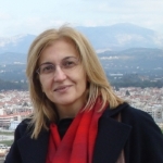 |
Dr. Chryssy Potsiou
|
The presentation will provide an introduction to the theme of the XXVI FIG Congress 2018, the vision and mission of FIG, the work plan and the major FIG achievements during the 4-year administration. Included are examples of cooperation with the UN, the World Bank, sister associations and other professional associations; and recognition of FIG members, workshops, major events, research, publications and administration.
Biograpy - Dr. Chryssy Potsiou graduated from the School for Rural & Surveying Engineering, National Technical University of Athens (NTUA) in 1982, and was awarded with the Technical Chamber of Greece (TCG) scholarship for her academic performance (2nd graduate of the year 1982). She has received a four-year scholarship from the NTUA to carryout doctoral studies in the fields of Photogrammetry and Cadastre. The title of her Ph.D. thesis was “Digital Cartographic Data for the Hellenic Cadastre”. During her graduate studies she has worked as teaching assistant in all classes offered by the NTUA in the fields of Photogrammetry, Cadastre, and Cartography. Also, during that period, she was elected as the graduate student representative at the General Assembly of the School of Rural and Surveying Engineering. In addition, she has contributed to committees related to the development of graduate and post-graduate programmes of that School. Since 1992, she has been employed as Special Research and Teaching Scientist at the Lab of Photogrammetry, Topography Division, School for Rural and Surveying Engineering, NTUA, at a permanent position. At the same time, she has been working as a consultant in several research projects.
 |
Prof. Ali Parsa, PhD, FRICS
|
We are standing on the cusp of the Fourth Industrial Revolution. But what impact would this revolution have on the development of our cities? How can we embrace and deliver the future demand for residential, commercial, industrial, retail and leisure property. What would be the shape of our cities? And how can the real estate industry meet such challenge? In 1950 the world population was 2.5 billion and only 746 million people lived in cities. By 2014 the world population had reached 7.2 billion with 3.9 billion living in cities. The world population is projected to reach 9.6 billion by 2050 and urban population 6.4 billion. To meet the expectations of this growing population our cities need to find innovative methods of resource management in terms of water, food, employment, utilities and urban infrastructure provision. Technology has the power to dramatically change the way we work, live and the built environment around us. Rapid technological innovations are driving and merging our physical and digital worlds.
This presentation will examine how different cities are rethinking their urban development strategies to embrace the Fourth Industrial Revolution. Furthermore it will postulate how the real estate industry could deliver the future cities utilising innovative technologies and financing methods.
Biography - Professor Ali Parsa joined the RAU in September 2012. Prior to his appointment at the RAU, he was Professor in Real Estate at the University of Salford and before that held the Rotary International Chair in Urban Planning and Business Development at the University of Ulster. His research is multi-disciplinary in nature but focuses primarily on emerging real estate markets, Shariah compliant real estate investment and the interface between urban planning and real estate markets, globalisation and urban development. Recent projects include “Viability and the Planning System: The Relationship between Economic Viability Testing, Land Values and Affordable Housing in London for a consortium of 13 London Boroughs, real estate strategies for tall buildings, environmental impacts of real estate and construction, urban land management, housing policy and housing market have been conducted for private and public sector clients in Europe, US, Asia and the Middle East. Professor Parsa was recently involved with an EU funded project on Commercial Local Urban District (CLUDs) – a comparative study of urban regeneration in the UK, Italy, Finland and USA involving a team of eight professors and 18 researchers in Italy, Finland, the UK and USA.
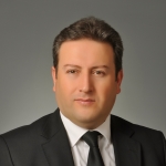 |
H. Mustafa Palancıoğlu, Ph.D.
|
(In the absence of Prof. mr. Mehmet Özhasekí Minister of Environment and Urban Planning)
Biography - Dr. Kayseri was born in 1970. H. Mustafa Palancıoğlu received primary, secondary and high school education in Kayseri. In 1992, he graduated from Yıldız Technical University, Department of Mapping Engineering. In the same university in 1995, he completed his master's degree with his thesis entitled "Designing City Information System of Aydın Municipality". In 1993, he started to work as a research assistant in the Department of Civil Engineering at Erciyes University. Later he completed his doctorate studies at the University of Maine in the United States between 1997-2002.
Dr. H. Mustafa Palancıoğlu, the return to Turkey in 2002 by the Department of Geomatics Engineering Erciyes University, he worked as an assistant professor until 2009. He is also the Vice President of Mapping Engineering and Head of the Department of Measurement Technology, Member of the Board of Directors of Develi Vocational Higher School, International Office EU Projects Coordinator, Erciyes Teknopark A.Ş. He was a member of the Board of Directors and an advisor to Kayseri Metropolitan Municipality.
Erciyes University has many branches such as Map, Construction, Industrial, Computer and Biomedical Engineering in various fields such as Location Measures, Geographical Information Systems, Real Estate Assessment and Management, Measurement Information, Technical English, Scientific Research and Presentation Techniques, Engineering Human Relationships and Entrepreneurship. He gave undergraduate courses. He also taught short courses at the Vaxjö University in Sweden in 2008 as part of the Erasmus Faculty Member exchange program.
He has many national and international scientific publications, awards and platitudes. H. Mustafa Palancıoğlu has served as a facilitator and researcher on many Scientific Research Projects of Tübitak and Erciyes University.
In addition, he is the director of many European Union Projects. H. Mustafa Palancıoğlu cooperated with the Czech Republic-Pardubice University on "Training and Implementation of Geographical Information Systems in European Countries", Germany-Huber A.Ş. , "Wastewater Treatment Facilities within the scope of Innovative Solutions for Municipalities", "Investigation of Railway Bulk-Transport System Applications in European Municipality" with the Austrian-Vienna Municipality and Hungary-Budapest Municipality and "Municipal Implementation and Urban Transformation Analysis in Budapest Municipality" projects.
Dr. H. Mustafa Palancıoğlu, T.C. He was appointed General Secretary of Central Anatolia Development Agency by the Prime Ministry State Planning Organization. Within this scope, he directed intensive activities for the preparation of development plans of Kayseri, Sivas and Yozgat provinces and provinces, financing and implementation of public and private sector institutional projects, mobilization and promotion of regional potentials. Palancıoğlu is separated from the post of the Development Agency for the election of local administrations in 2014.
Dr. H. Mustafa Palancıoğlu's areas of expertise include local development, urban planning, urban information systems, satellite positioning systems, real estate management, urban transformation, EU and Tubitak projects. Palancıoğlu is married with 4 children and knows English at a later stage.
Modern Technology
Usage for our Profession
|
 |
Dr. Juergen Dold President
|
We live in a world where we have digital resources and massive amounts of data stored in a vast reservoir of potential. The opportunities have never been more achievable for businesses to leverage what is digitised into new digitialised workflows that enable transformation. In this presentation, you’ll learn how new technologies are accelerating the shift to digitalisation, merging perception with reality into a digital reality, and how the creation of these digital realities is enabling the future of a smart, connected world.
Biography - With close to 30 years of experience in the geospatial industry, Dr. Juergen Dold serves as Hexagon’s Geosystems Division president. He directs the organisation’s global strategy in measurement technology, leading 5,000 professionals in more than 40 countries. Previous to this role, Dold served in many positions within the organisation from product manager to division president. He also served as academic counsel and assistant professor at the Institute for Photogrammetry and Image Processing at the Technical University Braunschweig where he oversaw research and development for various projects, including an expedition across the Greenland ice sheet. Dold holds a PHD in Engineering and serves on the boards of the Civil, Environmental and Geomatic Engineering Department of the ETH Zurich and the engineering, planning and consulting company Basler & Hofmann.
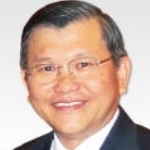 |
Mr. SeeLian Ong, Chair, FIG Commission 10
|
Financing desperately-needed buildings and infrastructure including energy systems, railways, bridges, schools and hospitals can often be risky because infrastructure projects across the globe categorise and forecast the construction costs differently. Until now, it has been almost impossible for governments and investors to compare construction costs like with like. It is hard for them to know if public infrastructure projects The new ICMS standard enables, for the first time, better comparison in order to improve investor confidence and attract more private sector funding.
Biograpy -
Dr. Ong has an illustrious career spanning over 40 years in both the public and private sectors. Dr. Ong was the President of the Royal Institution of Surveyors Malaysia, RISM (2003 – 2004) and Chairman of Pacific Association of Quantity Surveyors (PAQS) (2003 to 2005. He was the 130th Global President of the Royal Institution of Chartered Surveyors, RICS (2011-2012). His inauguration on 4th July 2011 was a historic event as he was the first non-British citizen, first Asian and the first Malaysian to be elected as the Global President of RICS. Currently he is the Chairman of FIG Commission for Construction Economics and Management (Commission 10). See Lian is also the elected Chairman of the Standard Setting Committee (SSC) for International Construction Measurement Standard (ICMS).
 |
Mr. Charles K. Toth
|
The Smart City concept and initiatives aim to exploit the potential of state-of-the-art technologies to make urban life better, and to revolutionize the way people move in metropolises. Among other key objectives, Mobility plays an essential role to improve the daily life of city dwellers, and includes many more components than the traditional transportation infrastructure. Mobility in a smart city environment is characterized by entire point-to-point transfer capabilities, real time communication among vehicles and citywide transportation management and control systems, intelligent traffic planning, promotion of public transport and vehicle sharing, and advanced interaction of all road users. Location data is a vital element of mobility, as any transportation and city entity, both static and moving objects, should be accurately positioned in time. Geospatial data acquisition capabilities have seen phenomenal developments recently, and modern geospatial technologies can efficiently support the high performance requirements of mobility. For example, as vehicle technology is moving towards higher autonomy, the demand for highly accurate map data and city models is rapidly increasing, as accurate maps have a huge potential to increasing safety. In particular, engineering scale 3D maps, including road topography and infrastructure as well as city models along the transportation corridors represent tremendous support for driverless vehicles. This presentation offers an overview of the state-of-the-art in sensing with a focus on mobility in smart cities and autonomous/assisted vehicle technologies.
Biography - Charles K. Toth is a Research Professor in the Department of Civil, Environmental and Geodetic Engineering, The Ohio State University. His research interest and expertise cover broad areas of spatial information sciences and systems, including photogrammetry, multi-sensor geospatial data acquisition systems, LiDAR, high-resolution imaging, surface extraction, modeling, integrating and calibrating multi-sensor systems, georeferencing and navigation, 2D/3D signal processing, and mobile mapping technologies. He has published over 350 peer-reviewed journal and proceedings papers, and is the recipient of numerous awards, including the 2009 APSRS Photogrammetric Award, United States Geospatial Intelligence Foundation (USGIF) Academic Achievement Award, 2015, ISPRS Schwidefsky Medal Winner 2016, several Lumley Research Awards from OSU, and various best papers awards. Widely recognized in the international mapping community, he has held many senior leadership positions in national and international societies, and was the President of the American Society of Photogrammetry and Remote Sensing (ASPRS), served as the ISPRS Technical Commission I President for 2012-2016, and is currently ISPRS 2nd Vice-President.
Theme: Rural Development
|
 |
Dr. Michael Klaus
|
Rural development is of particular importance in sustainable development goals, in part as in many developing countries over half the population live in rural areas. Achieving sustainable development goals, therefore will not be possible unless agricultural productivity and rural incomes increase. Many relationships exist between the urban and rural areas. These linkages are what drive economic, social and cultural transformations. Urban areas are very important to rural areas and vis-à-vis. Many urban and rural problems, which stand in the way of sustainable development goals, are often linked to the relationship between urban and rural areas. Therefore, the strategies for rural and urban areas cannot be discussed as separate items. Rather, rural and urban development approaches should be built around the objective of fostering the rural-urban interrelationship.
Biography -
Dr. Michael Klaus is the Director of the Hanns Seidel Foundation (HSS) Representative Office Shandong, P.R. China. He studied Geodesy at the Technical University of Munich and in 2003 he received a Doctoral Degree in sustainable land development. His specialization is geodetic engineering and land management. From 1995 to 2012 he worked at the Chair of Land Management, at the Technical University of Munich. Since 2012 he is on leave and is leading the Project “Development of Rural Areas in China” as a component of the “Regional Project China” of Hanns-Seidel Foundation. Since May 2017 he is appointed as a Visiting Professor at the Department for Public Administration and Policy of the Renmin University Beijing, China.
 |
Mr. Jawad Peikar
|
Mr. Peikar, CEO Afghanistan Independent Land Authority (ARAZI), will discuss land policy, new laws, the Land Governance Assessment Framework (LGAF) diagnostic study completed in 2016, land governance, the High Council on Land and “state to state cooperation” in land administration and some inputs from the Strategic Institutional Development Plan for Land Administration (IDPL). Afghanistan lacks a land administration system that transparently addresses State land, the customary rights, responsibilities and institutions that people relate to, with policies, laws and procedures that record land ownership, land values, land use and other land related data for sustainable management of land and resources. Three-quarters of the population live in rural areas, with agriculture accounting for more than half of the countries employment and one-quarter of GDP. Land conflict in Afghanistan runs high with at last 70 percent of all legal conflicts concerned with and more than 60 percent of all land conflicts concerned with pasture lands. Only 20-30 percent of urban and 10 percent of rural properties have been registered by official institutions of the state. The government has already identified almost 16,000 land grabbers, many of who have high level connections. The Afghanistan Independent Land Authority (ARAZI) was established in 2013 and has the mandate for land administration, national mapping and geodesy. The existing judicial deeds system, which only covers urban areas, and is notoriously corrupt, will be replaced by an administrative land titling system, with government guarantee. In 2014, the President issued his Manifesto for Afghanistan’s development, the core of which is to establish a sustainable, transparent land administration system that draws upon good international practices, policy and technologies, that are fit-for-purpose. ARAZI is working with development partners and is specifically establishing a bilateral partnership with Turkey to support land administration. This address will discuss the Afghanistan land administration challenges and the approaches to achieve a sustainable land administration system with good land governance that supports responsible economic development, is pro-poor, promotes gender equity with high citizen engagement.
Biography -
Since May 2013, Mr. Jawad Peikar has been the Chief Executive Officer (CEO) for the Afghanistan Independent Land Authority (ARAZI), and based on a Presidential decree in June 2015 he has been re-appointed as the CEO of the Afghanistan Independent Land Authority(ARAZI). With establishment of High Council of Land and Water under leadership of H.E the President, Mohammad Ashraf Ghani, he has become member of the Council, and also manages the secretariat of the Council. Due to importance of land issues in the country, Mr. Peikar is a member of Cabinet of the Government of Islamic Republic of Afghanistan. Has worked both for national and international organizations within the country mostly at the managing and leadership positions. Mr. Peikar is a lawyer, educated in the US.
 |
Mr. Brent Jones
|
Biography - As Esri’s global manager of cadastre/land records, based in Washington D.C., USA, Brent Jones oversees Esri’s worldwide strategic planning, business development and marketing activities for land records, cadastral, surveying and land administration. As a recognised technology innovator, Jones specialises in modernising existing land administration systems and designing new GIS-based cadastral management platforms for small and large governments around the globe. He is a member of the URISA board of directors, past president of the Geospatial Information and Technology Association and a current member of the United Nations Committee of Experts on Geospatial Information Management (UN-GGIM), sitting on the Expert Group on Land Administration and Management.
Theme: Spatially Enabled
Societies
|
 |
Dr.
Keith Clifford Bell
|
Biography -
Dr. Keith Clifford Bell joined the World Bank in 2003 and works as a specialist technical adviser for land and geospatial technologies, globally. During his tenure with the World Bank he has worked in some fifteen countries across Asia, the Middle East and Latin America, including conflict and fragile states as well as in support of post-disaster reconstruction. Prior to the World Bank, he spent more than two decades in the Australian public and private sectors, which has included heading land agencies in two states, as well as programs for national mapping and also the national coordination of spatial data infrastructure. Dr. Bell, an Australian national, is a licensed surveyor and professional engineer (civil). He is a Fellow of several professional institutions including the Institution of Surveyors Victoria Australia, the Institution of Engineers Australia and the American Society of Civil Engineers. In addition, he has had a parallel military career with the Australian Army, continuing to serve in a reserve capacity.
 |
Prof. Abbas Rajabifard
|
The concept of spatially enabled societies (SES) involves establishing an infrastructure that facilitates the use of geographic location to organise information about the activities of citizens, businesses, government actions, decision-making processes and polices. In the era of hyper-connected societies where people, businesses and governments are connected across different locations, the integration of such an infrastructure would allow government information and services, business transactions and community activities to be linked to locations. Linking data to location and subsequently, spatially enabling societies will, therefore, develop smart communities that efficiently address social, economic, and environmental challenges pertinent to their specific location.
The idea of SES, argues that the inclusive establishment of economic
wealth, social stability and environmental protection could be achieved
through developing products and services based on spatial information
collected by all levels of society. These social, economic, and
environmental objectives can be accomplished by cultivating an environment
in which “spatial information is regarded as a common good made available to
citizens and businesses to encourage creativity and product development”.
This would require data to be accessible, accurate, regularly maintained and
sufficiently reliable for use by the majority of society who are not
spatially aware. Moreover, SES necessitate some form of “assessment
mechanism” and a set of agreed indicators to measure the progress of its
development and the delivery of its services. SES is the result of a
transformative process in which spatial information technologies and
spatially equipped citizens change the way economies, people, and
environments are organized to create a sustainable future for all.
In addition, new technologies, digital data streams and participation models
are generating new knowledge that is being used to inform city planning,
management and governance. In this context, spatial information, cadastre
and associated spatial data platforms such as spatial data infrastructure
(SDI) are that backbone of efficient urban government and governance to
support the delivery of our smart future cities. While cities become smart,
they are turning to be more complex, because of population growth and the
interdependency of urban entities and infrastructures. Thus, the delivery of
a sustainable and resilience society requires robust spatial data platform,
policy, legal and institutional considerations.
In conjunction with the smart communities and cities movement, the United Nations Sustainable Development Goals (SDGs) aim to create a future inclusive of all people and in every location. In order to address challenges at local, national, and global levels we need to create a reliable spatial data ecosystem to enhance the development and implementation of solutions for achieving the SDGs. Therefore, SES is a critical factor in building smart communities and infrastructures, and a sustainable future for all.
This presentation will focus on two key questions: what the term “spatial enablement” mean? and how is something “spatially enabled”? Building from a deep understanding of SDIs, the presentation will discuss the current trends in spatial enablement and opportunities created for wider societies. It will then showcase the key role and the relationships between SES and the SDGs to better serve all levels of societies and build smart communities. The presentation will also explore the role of spatial data analytics to support sustainable future cities as part of SDG agenda.
Biography - Professor Abbas Rajabifard is
Head of Department of Infrastructure Engineering and Director of the Centre
for Land Administration and Spatial Data Infrastructures at the University
of Melbourne. He is also Chair of the United Nations Global Geospatial
Information Management Academic Network, which is a strategic research and
training arm for member states to address UN Sustainable Development Goals
(SDGs).
Abbas has spent his career researching, developing, applying and teaching SDI, land administration and spatial enablement and strategies to deliver benefits to both governments and wider society. He has widely consulted and published in these areas. His current research is on the design and development of Urban Analytics Data Infrastructure to support SDGs, resilience and smart cities and communities.
 |
Dr. Victor Khoo,
Senior Deputy Director
|
The sustainable, resilient and smart Cities of the Future will be powered by the effective use of technologies and innovative exploitation of data to improve the lives of its inhabitants and communities. Singapore’s vision to become a Smart Nation requires high quality, high resolution and reliable data. Hence, comprehensive geoinformation and operational geo-reference infrastructure are critical components in this development. Singapore Land Authority (SLA) is the government agency responsible for the surveying, mapping and geospatial information in Singapore. SLA’s scope of work includes the approval of cadastral survey, updating of ownership information, maintenance of geodetic and GNSS infrastructure, topographic mapping and operation of Spatial Data Infrastructure (SDI). SLA has put in place fundamental systems that is allow us to capture, create, manage and deliver fundamental digital geodata and geoinformation for the whole-of-government. This presentation highlights the role of geoinformation and geo-reference infrastructure in the development of a Smart Nation.
Biography -
Dr. Victor Khoo is the Senior Deputy Director in Land Survey Division of Singapore Land Authority (SLA). He received his Ph.D. and Master of Engineering degree from Nanyang Technological University (NTU), Singapore and his Bachelor degree in Land Surveying from the University Technology of Malaysia (UTM). Victor is also a Registered Surveyor; a professional surveyor, registered under the purview of Land Surveyors Act administered by Singapore Land Surveyors Board. He works in diverse geospatial and mapping related subjects that encompass the collection, management and dissemination of geospatial and mapping information. His specific areas of interest include Differential GNSS, Cadastral Surveying, 3D Mapping and Spatial Data Infrastructure.